The Storytellers: Deception at Sea
Creating a deception in the context of the employment of a naval force is the ability to tell the opponent a story that is different from reality. A successful psychological feint can generate deterrence at the strategic level as well as providing a tactical advantage
Yotam Gutman & Ami Rojkes Dombe
| 17/11/2017
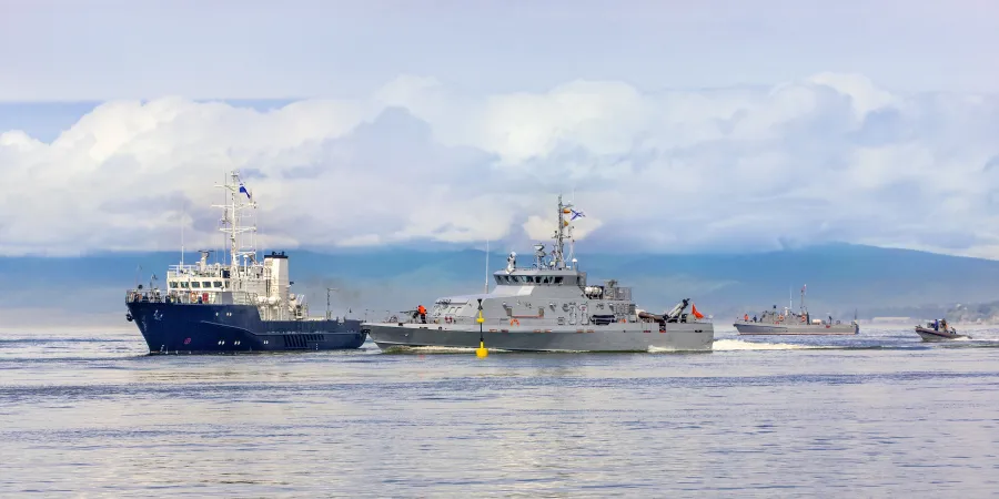
Image: Bigstock
Intelligence collection in the maritime (naval) theater of operations is one of the primary challenges facing naval forces in 2017, despite the resources currently available. Naval intelligence may be divided into two major efforts – assembling an operational naval status picture for border defense, and collection of long-range naval intelligence. These two efforts involve two mutually-complementary but almost separate intelligence setups that assemble their respective status pictures differently. The Achilles' heel of these intelligence collection setups is their limited ability to corroborate and verify their maritime information. This gap can provide opportunities for psychological deception operations in the context of the employment of naval forces.
Using deception tactics in the context of the employment of naval forces is the ability to tell the opponent a story that is different from reality, using a combination of several dimensions that affect how the opponent's decision makers perceive reality. A successful psychological feint can generate deterrence at the strategic level and can cause the opponent to spend the ordnance of his naval vessels on unimportant targets, thereby gaining a tactical advantage.
One of the most notable deception operations in history was Operation Fortitude, initiated by the allies during World War II for the purpose of misleading the Nazis regarding the location of the intended allied invasion into Europe. This operation included the use of a diversified range of dummy tools, double agents and other efforts that jointly created a misrepresentation of the build-up of a non-existent military force. Another example involves the floating radar decoy Thesis, used by the Nazis to deceive the surveillance aircraft of the USA. The Thesis decoy reflected the signals of US radars so as to simulate a surfaced German U-Boat.
Another example involves the Q-Ships used by the British during WWII to deceive the Germans. These vessels looked like merchant ships but in fact were equipped with anti-submarine weapon systems.
The Club-K Kalibr cruise missile container is a modern-day deception system. This innocent-looking sea freight container may be loaded onto any container ship, but it can launch Kalibr cruise missiles at the push of a button.
Assembling the Naval Status Picture
The naval status picture is assembled by a coastal command layout. This primarily-operational picture is based on input from radar stations, airborne platforms fitted with SAR radars, AIS data and reports from the naval vessels, transmitted through their communication channels. This naval picture provides situational awareness for an area within a distance that is fairly close to the national borders, with coverage extending to the EEZ (Exclusive Economic Zone) and slightly beyond.
Along with the close-range operational picture, a naval intelligence picture is also being assembled for the more distant naval theater. This picture includes the coastal layout of the enemy and his naval vessels, foreign naval forces, monitoring of merchant ships and smuggling activities at longer ranges from the shore. This intelligence collection effort relies mainly on input from ElInt and ComInt sensors fitted to aircraft as well as on SAR/optical satellite imagery. Additionally, this naval intelligence effort relies on cooperative alliances with foreign countries and on HumInt (Human Intelligence) information provided by the intelligence agencies.
The assembly of a naval target picture is based on the employment of passive and active surveillance resources intended to detect, identify and track targets. Unlike the assembly of a picture of ground targets, which is normally based on visual detection (surveillance systems, reconnaissance aircraft and satellite imagery), the lion's share of the naval target picture is assembled by radars capable of spotting the location data and movement characteristics of a target – but incapable of identifying it. The implication of this fact is that military naval vessels cannot be distinguished from civilian vessels of the same size and having the same movement characteristics – they both appear as blips on the Radar screen.
If the vessel travels along a route typically used by merchant ships, it will normally be identified as a merchant ship until additional data have been collected to enable positive identification (marine terrorist detachments used such routes in the context of past terrorist attacks against Israel, like the attack on the Coastal Highway, the Savoy Hotel attack and the attack at the Nitzanim Beach). The data of different intelligence sensors is 'fused' to enable identification of additional details as the type of vessel, country of departure, etc.
Many Means, Low Level of Verifiability
As stated, the existing naval intelligence effort is based on input from several collection resources that jointly assemble a complete intelligence picture, intended to provide situational awareness for the close range naval theater as well as for the more distant range. In reality, however, the level of effectiveness of these tools in providing continuous, reliable and verifiable situational awareness – is very low, especially with regard to the operational naval picture, which changes at a faster rate.
If we take, for example, the AIS (Automatic Identification System) protocol, it is based on a transmitter installed on every ship from a certain tonnage and over, which continuously transmits the location and identification data of the using vessel. These transmissions are picked up by satellites that relay them to data collection systems and to coastal stations. These data may be used to run various analyses that make it possible to identify the transmitting vessel. In theory, every ship has its own unique signature that identifies it at any given moment.
The problem starts with military (naval) vessels. In most cases, these vessels do not activate their AIS transmitters as they do not want to be detected. The AIS transmitter also enables the using vessel to classify itself falsely, for deception purposes. The use of AIS data does not include a verification capability.
Optical surveillance measures are also limited in range. They are effective for detecting naval vessels close to the shore. Whereas the range of the missiles carried by the various missile ships (including cruise missiles) has increased in recent years, the standoff range of these vessels places them beyond the range of the optical surveillance measures. Consequently, the level of effectiveness of these measures is low. Coastal radars used to detect naval vessels at sea are also limited in their range and are mainly used as coastal stations responsible for monitoring the national territorial waters.
Airborne surveillance measures, including mission aircraft and UAS fitted with radars capable of detecting surface vessels and submarines, are not the kind of resource permanently positioned over a specific area cell. These platforms are employed in periodic operations or according to specific intelligence information to collect pin-point intelligence, prior to an operation or according to specific intelligence information that directs them to a specific area of interest. These vehicles are extremely costly to acquire and maintain, and are only available in small numbers to the countries that can afford to acquire and use them – not all of the world's countries have these measures.
Satellites are another tool that does not enable continuous monitoring of an area cell at sea. The satellite passes over a certain point several times during the day, according to its orbit, and its ability to produce images of that point depends on the cloud cover and whether its payload is optical. SAR payloads can produce images through the clouds as well, but once again – they can only "photograph" the point of interest a limited number of times per day. Whereas naval vessels are mobile and do not remain in one point, the probability of tracking them using a satellite is very low indeed. In this case, too, only very few countries possess surveillance/SAR satellites.
Disrupting the Enemy's Perception of Reality
The absence of an ability to collect continuous intelligence in sea area cells and the difficulty in verifying and corroborating the intelligence data being collected provide the opportunity for the use of psychological deception in the context of the employment of naval forces. Psychological deception operations are intended to disrupt the way in which the enemy's intelligence layout perceives reality.
For the purpose of this discussion, a clear distinction should be made between psychological feint for deterrence purposes and battlefield tactical deception. In the maritime theater, deception may be accomplished through the use of USVs, chaff and buoys, for the purpose of saturating the enemy's target picture and making it difficult for the enemy to detect the real targets and their objectives. Psychological deception may be used for deterrence purposes by planting hundreds of military dummy targets, through the AIS protocol, into the status picture of defending side's coastal layout, thereby deterring him from going out to see to begin with (deterrence by denial).
As far back as 2013, the Trend Micro Company proved that AIS systems may be used to create entities under different names and in locations as per the user's choice. The ability to "create" targets through well-established systems or to change target location data can be useful for a potential military aggressor. One should bear in mind the fact that the maritime theater is used mainly for maritime transportation and for commercial fishing, and that the AIS technology is practically the only tool available for monitoring such activities.
Other systems that may be used for deception at sea are the communication systems of naval vessels. The locations of naval vessels can be spotted by intercepting the communication traffic in and out of the vessel – mostly through satellite communication systems or low-frequency systems. In these cases, transmitting false location data and fake orders that match the fake AIS identity can deceive the enemy. If the intelligence-collecting party monitors the communication traffic and notices certain activity, but has no way to corroborate and verify the information using visual or radar resources, he might think that what he has noticed is real.
Another dimension that has entered the maritime theater in recent years is cyber, which has been included in the same category as electronic warfare. The cyber element makes it possible not just to jam or disrupt electronic systems, but to manipulate the information as well. The US authorities have already stated that US Navy submarines possess offensive cyber capabilities. If in addition to manipulating the AIS and the communication networks, data may be injected into or disrupted in the intelligence collection systems of the other side, it will be possible to create a misrepresentation of naval activity. The objective of psychological deception operations is to influence the judgment of the decision makers on the other side. These decision makers rely on digital or analog systems that transmit data to display screens. Once the chain of command lacks information verification measures, a psychological deception operation that combines cyber, EW and communication deception capabilities, as well as manipulation of AIS systems, will almost certainly affect their perception of the battlefield.

Creating a deception in the context of the employment of a naval force is the ability to tell the opponent a story that is different from reality. A successful psychological feint can generate deterrence at the strategic level as well as providing a tactical advantage
Image: Bigstock
Intelligence collection in the maritime (naval) theater of operations is one of the primary challenges facing naval forces in 2017, despite the resources currently available. Naval intelligence may be divided into two major efforts – assembling an operational naval status picture for border defense, and collection of long-range naval intelligence. These two efforts involve two mutually-complementary but almost separate intelligence setups that assemble their respective status pictures differently. The Achilles' heel of these intelligence collection setups is their limited ability to corroborate and verify their maritime information. This gap can provide opportunities for psychological deception operations in the context of the employment of naval forces.
Using deception tactics in the context of the employment of naval forces is the ability to tell the opponent a story that is different from reality, using a combination of several dimensions that affect how the opponent's decision makers perceive reality. A successful psychological feint can generate deterrence at the strategic level and can cause the opponent to spend the ordnance of his naval vessels on unimportant targets, thereby gaining a tactical advantage.
One of the most notable deception operations in history was Operation Fortitude, initiated by the allies during World War II for the purpose of misleading the Nazis regarding the location of the intended allied invasion into Europe. This operation included the use of a diversified range of dummy tools, double agents and other efforts that jointly created a misrepresentation of the build-up of a non-existent military force. Another example involves the floating radar decoy Thesis, used by the Nazis to deceive the surveillance aircraft of the USA. The Thesis decoy reflected the signals of US radars so as to simulate a surfaced German U-Boat.
Another example involves the Q-Ships used by the British during WWII to deceive the Germans. These vessels looked like merchant ships but in fact were equipped with anti-submarine weapon systems.
The Club-K Kalibr cruise missile container is a modern-day deception system. This innocent-looking sea freight container may be loaded onto any container ship, but it can launch Kalibr cruise missiles at the push of a button.
Assembling the Naval Status Picture
The naval status picture is assembled by a coastal command layout. This primarily-operational picture is based on input from radar stations, airborne platforms fitted with SAR radars, AIS data and reports from the naval vessels, transmitted through their communication channels. This naval picture provides situational awareness for an area within a distance that is fairly close to the national borders, with coverage extending to the EEZ (Exclusive Economic Zone) and slightly beyond.
Along with the close-range operational picture, a naval intelligence picture is also being assembled for the more distant naval theater. This picture includes the coastal layout of the enemy and his naval vessels, foreign naval forces, monitoring of merchant ships and smuggling activities at longer ranges from the shore. This intelligence collection effort relies mainly on input from ElInt and ComInt sensors fitted to aircraft as well as on SAR/optical satellite imagery. Additionally, this naval intelligence effort relies on cooperative alliances with foreign countries and on HumInt (Human Intelligence) information provided by the intelligence agencies.
The assembly of a naval target picture is based on the employment of passive and active surveillance resources intended to detect, identify and track targets. Unlike the assembly of a picture of ground targets, which is normally based on visual detection (surveillance systems, reconnaissance aircraft and satellite imagery), the lion's share of the naval target picture is assembled by radars capable of spotting the location data and movement characteristics of a target – but incapable of identifying it. The implication of this fact is that military naval vessels cannot be distinguished from civilian vessels of the same size and having the same movement characteristics – they both appear as blips on the Radar screen.
If the vessel travels along a route typically used by merchant ships, it will normally be identified as a merchant ship until additional data have been collected to enable positive identification (marine terrorist detachments used such routes in the context of past terrorist attacks against Israel, like the attack on the Coastal Highway, the Savoy Hotel attack and the attack at the Nitzanim Beach). The data of different intelligence sensors is 'fused' to enable identification of additional details as the type of vessel, country of departure, etc.
Many Means, Low Level of Verifiability
As stated, the existing naval intelligence effort is based on input from several collection resources that jointly assemble a complete intelligence picture, intended to provide situational awareness for the close range naval theater as well as for the more distant range. In reality, however, the level of effectiveness of these tools in providing continuous, reliable and verifiable situational awareness – is very low, especially with regard to the operational naval picture, which changes at a faster rate.
If we take, for example, the AIS (Automatic Identification System) protocol, it is based on a transmitter installed on every ship from a certain tonnage and over, which continuously transmits the location and identification data of the using vessel. These transmissions are picked up by satellites that relay them to data collection systems and to coastal stations. These data may be used to run various analyses that make it possible to identify the transmitting vessel. In theory, every ship has its own unique signature that identifies it at any given moment.
The problem starts with military (naval) vessels. In most cases, these vessels do not activate their AIS transmitters as they do not want to be detected. The AIS transmitter also enables the using vessel to classify itself falsely, for deception purposes. The use of AIS data does not include a verification capability.
Optical surveillance measures are also limited in range. They are effective for detecting naval vessels close to the shore. Whereas the range of the missiles carried by the various missile ships (including cruise missiles) has increased in recent years, the standoff range of these vessels places them beyond the range of the optical surveillance measures. Consequently, the level of effectiveness of these measures is low. Coastal radars used to detect naval vessels at sea are also limited in their range and are mainly used as coastal stations responsible for monitoring the national territorial waters.
Airborne surveillance measures, including mission aircraft and UAS fitted with radars capable of detecting surface vessels and submarines, are not the kind of resource permanently positioned over a specific area cell. These platforms are employed in periodic operations or according to specific intelligence information to collect pin-point intelligence, prior to an operation or according to specific intelligence information that directs them to a specific area of interest. These vehicles are extremely costly to acquire and maintain, and are only available in small numbers to the countries that can afford to acquire and use them – not all of the world's countries have these measures.
Satellites are another tool that does not enable continuous monitoring of an area cell at sea. The satellite passes over a certain point several times during the day, according to its orbit, and its ability to produce images of that point depends on the cloud cover and whether its payload is optical. SAR payloads can produce images through the clouds as well, but once again – they can only "photograph" the point of interest a limited number of times per day. Whereas naval vessels are mobile and do not remain in one point, the probability of tracking them using a satellite is very low indeed. In this case, too, only very few countries possess surveillance/SAR satellites.
Disrupting the Enemy's Perception of Reality
The absence of an ability to collect continuous intelligence in sea area cells and the difficulty in verifying and corroborating the intelligence data being collected provide the opportunity for the use of psychological deception in the context of the employment of naval forces. Psychological deception operations are intended to disrupt the way in which the enemy's intelligence layout perceives reality.
For the purpose of this discussion, a clear distinction should be made between psychological feint for deterrence purposes and battlefield tactical deception. In the maritime theater, deception may be accomplished through the use of USVs, chaff and buoys, for the purpose of saturating the enemy's target picture and making it difficult for the enemy to detect the real targets and their objectives. Psychological deception may be used for deterrence purposes by planting hundreds of military dummy targets, through the AIS protocol, into the status picture of defending side's coastal layout, thereby deterring him from going out to see to begin with (deterrence by denial).
As far back as 2013, the Trend Micro Company proved that AIS systems may be used to create entities under different names and in locations as per the user's choice. The ability to "create" targets through well-established systems or to change target location data can be useful for a potential military aggressor. One should bear in mind the fact that the maritime theater is used mainly for maritime transportation and for commercial fishing, and that the AIS technology is practically the only tool available for monitoring such activities.
Other systems that may be used for deception at sea are the communication systems of naval vessels. The locations of naval vessels can be spotted by intercepting the communication traffic in and out of the vessel – mostly through satellite communication systems or low-frequency systems. In these cases, transmitting false location data and fake orders that match the fake AIS identity can deceive the enemy. If the intelligence-collecting party monitors the communication traffic and notices certain activity, but has no way to corroborate and verify the information using visual or radar resources, he might think that what he has noticed is real.
Another dimension that has entered the maritime theater in recent years is cyber, which has been included in the same category as electronic warfare. The cyber element makes it possible not just to jam or disrupt electronic systems, but to manipulate the information as well. The US authorities have already stated that US Navy submarines possess offensive cyber capabilities. If in addition to manipulating the AIS and the communication networks, data may be injected into or disrupted in the intelligence collection systems of the other side, it will be possible to create a misrepresentation of naval activity. The objective of psychological deception operations is to influence the judgment of the decision makers on the other side. These decision makers rely on digital or analog systems that transmit data to display screens. Once the chain of command lacks information verification measures, a psychological deception operation that combines cyber, EW and communication deception capabilities, as well as manipulation of AIS systems, will almost certainly affect their perception of the battlefield.