IDF Releases Map of Hezbollah Positions in Southern Lebanon
The map reveals thousands of Hezbollah positions along the Israel-Lebanon border and shows that Hezbollah is deeply embedded in civilian population centers in Lebanon
IsraelDefense
| 07/12/2016
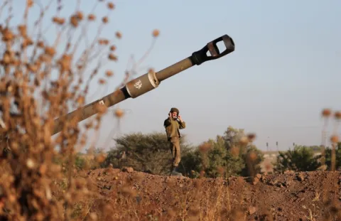
 Explosives on the Israel-Lebanon border (Photo: IDF)
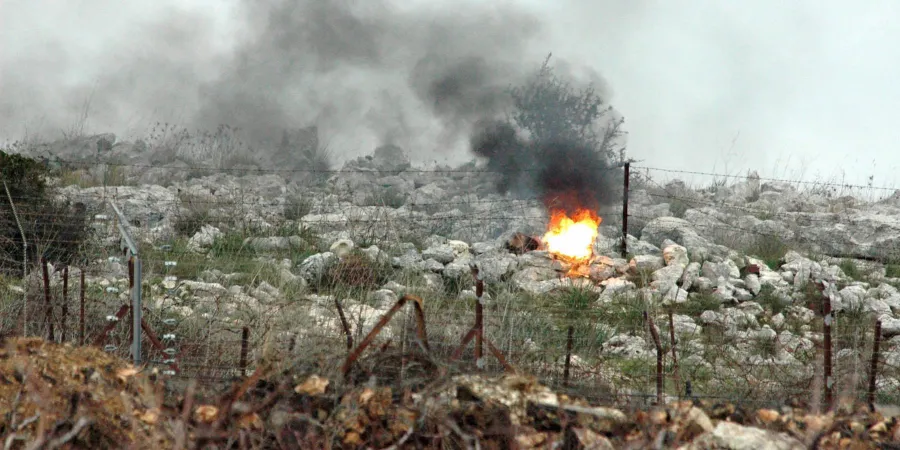
The IDF released a previously classified map showing where Hezbollah has embedded itself in civilian population locations throughout southern Lebanon, reports The Jewish Press.
The map indicates the location of Iranian-backed Hezbollah weapon warehouses, rocket launchers, infantry, underground tunnels and infrastructure, anti-tank positions and command posts, all of them embedded in or around civilian homes and population centers.
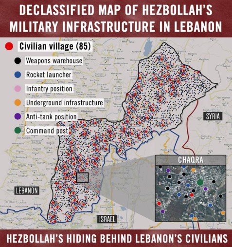
The Times of Israel adds that the map features over 200 towns and villages which the organization has turned into its operations bases, and shows over 10,000 potential targets for Israeli strikes in the event of a new war with the terror group.
A caption on the photo noted that it had been declassified, in an apparently calculated move by Israel to build a case for any future military action. It could also serve as a warning to the terror group itself, demonstrating Israel’s intelligence gathering capabilities as a deterrent.
The map reveals thousands of Hezbollah positions along the Israel-Lebanon border and shows that Hezbollah is deeply embedded in civilian population centers in Lebanon
The IDF released a previously classified map showing where Hezbollah has embedded itself in civilian population locations throughout southern Lebanon, reports The Jewish Press.
The map indicates the location of Iranian-backed Hezbollah weapon warehouses, rocket launchers, infantry, underground tunnels and infrastructure, anti-tank positions and command posts, all of them embedded in or around civilian homes and population centers.
The Times of Israel adds that the map features over 200 towns and villages which the organization has turned into its operations bases, and shows over 10,000 potential targets for Israeli strikes in the event of a new war with the terror group.
A caption on the photo noted that it had been declassified, in an apparently calculated move by Israel to build a case for any future military action. It could also serve as a warning to the terror group itself, demonstrating Israel’s intelligence gathering capabilities as a deterrent.